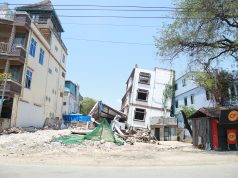
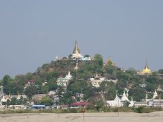
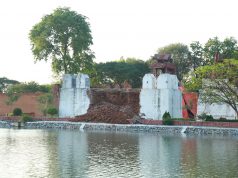
With difficulties in accessing the actual affected areas by media organisations due to the government’s lack to adequate resources to provide security and accommodation details, MI has decided to volunteer ourselves to venture deep into the centre of the quake impacted areas on a road trip from Yangon. With the intention of making a documentary less than a month into the disaster, we had discovered many that the world has not seen and collected evidences ourselves to counter many mis-information farmed out by foreign anti government media entities. Along the way, we also did many good deeds donating to many of those in need while trying to pinpoint the genuine areas in need of assistance.
Quake details
The big one occurred on March 28, 2025, near Mandalay, occurred as the result of strike slip faulting between the India and Eurasia plates. M7.7 earthquake occurred around noon at exactly 12:50, saving many from certainly of demise and allowing many hours of daylight time to do rescue operations.
The finite fault solution, informed by satellite observations, indicates the size of the March 28, 2025 event is about 460 km by 15 km (length x width). This region has experience similar large strike slip earthquakes, with six other magnitude 7 and larger earthquakes, occurring with about 150 miles (250 km) of the March 28, 2025 earthquake since 1900.
The most recent of these was a magnitude 7.0 earthquake in January 1990, which caused 32 buildings to collapsed. A magnitude 7.9 earthquake occurred south of today’s earthquake in February 1912. Within this broad zone of tectonic deformation, other large earthquakes, including a magnitude 7.7 earthquake in 1988, have caused dozens of fatalities.
Phone lines, electricity, water supply and internet access were all unavailable for many hours right after the quake, making rescue and coordination inaccessible to many of the first responders. So far, as of April 20, the reported death toll announced by the government stood slightly below 5,ooo. Based on our own projections after our nationwide tour, the final figure could be closer to 10,000 when the dust settles.
Destination the epicentre
As mentioned in the previous March MI issue, some of our staff, including our editor was right in the centre of the quake in Nay Pyi Taw on the Taung Nyo Road travelling from Myo Ma Market to Yazar Thingaha Road. He has already witnessed the magnitude of devastation in Nay Pyi Taw, the capital.
Within a couple of days we already heard from our local and expat sources that cities and towns along the old Yangon Mandalay Road were also severely affected.
Hence, we planned our trek to cover the towns along the old road, exiting the expressway from Taung Ngyu to reach Nay Pyi Taw via the old road and again taking the former highway to get to Mandalay from Nay Pyi Taw. From the capital of the old Kingdom of Burma i.e., Mandalay, we set forth towards Sagaing, Amara Pura and beyond.
Along the route
Other than some serious shaking throughout the nation, especially in Yangon, major damages were not noticeable until we reached the capital. Along the way to Nay Pyi Taw, the destruction to roads, bridges, pavements and curb blocks did not appear till we reached around 147 mile marker and get worse and worse as we get closer to Mandalay.
But the government was quick in getting the repairs done and more than 95% of the expressway was in operation (with careful driving) and nearly all roads in Nay Pyi Taw had temporarily been restored to usable conditions.
In addition to exploring the havoc caused to Pyin Mana, the next door neighbour to Nay Pyi Taw, we passed by five many towns along the quake track, namely Ya Mei Thin, Pyaw Bware One Twin, Ku Mare and Kyauk Se, along our route from the administrative capital to Mandalay.


